When You Constantly Push Your Limits You Will Never Reach Them

Category: Uncategorized (Page 166 of 339)

This Gorgeous Natural Spring In Missouri Is A Sight To Be Seen

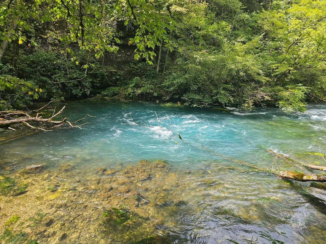
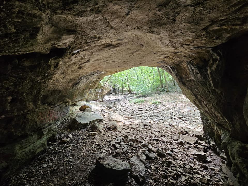
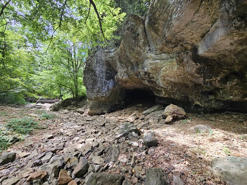
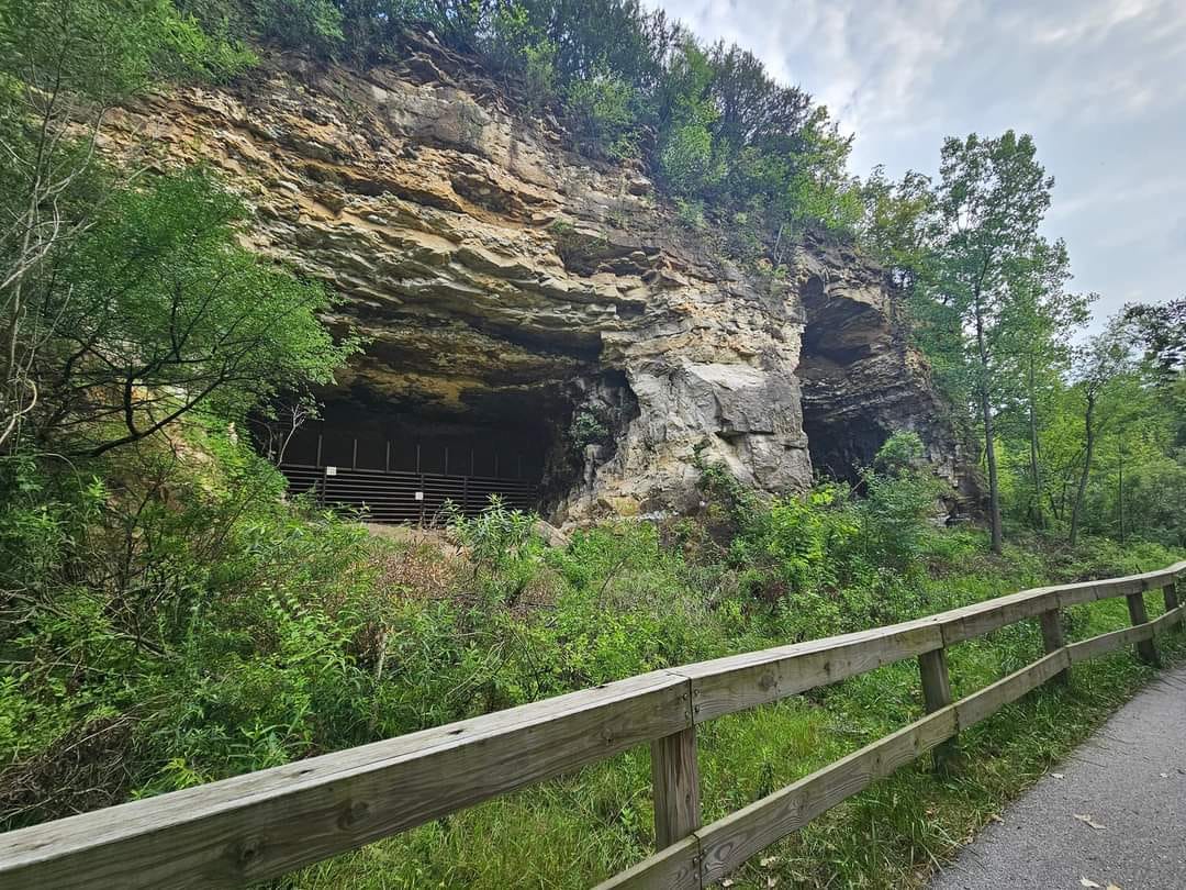
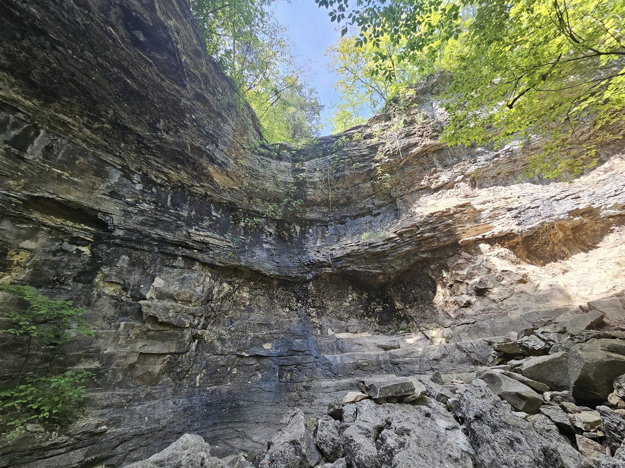
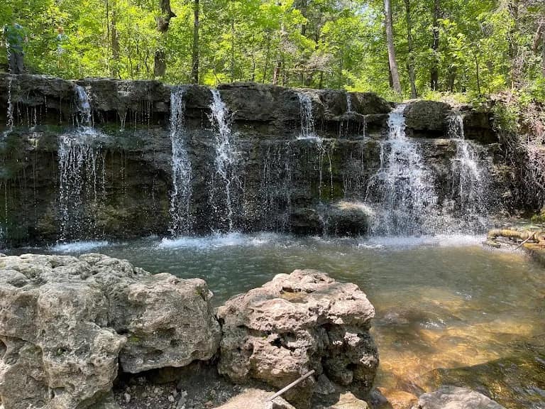
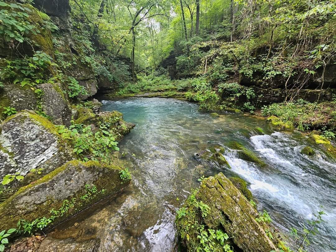
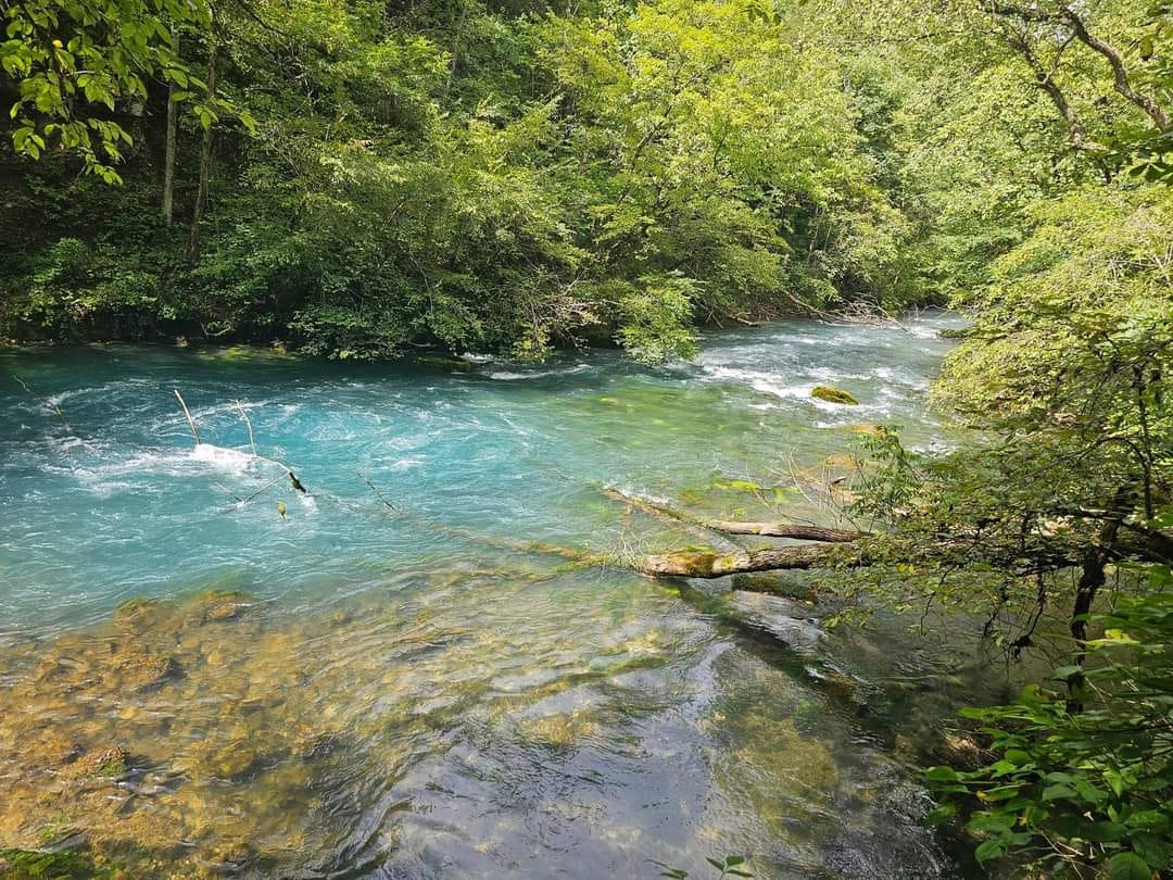
One of the most significant natural features in Missouri, Greer Spring, is the second largest spring in the state with a mean daily discharge of approximately 210 million gallons/day. The trailhead is located 18 miles south of Winona and 8 miles north of Alton on MIssouri Highway 19 about 1.5 miles south of the Highway 19 bridge that crosses the Eleven Point River and just north of the tiny town of Greer.

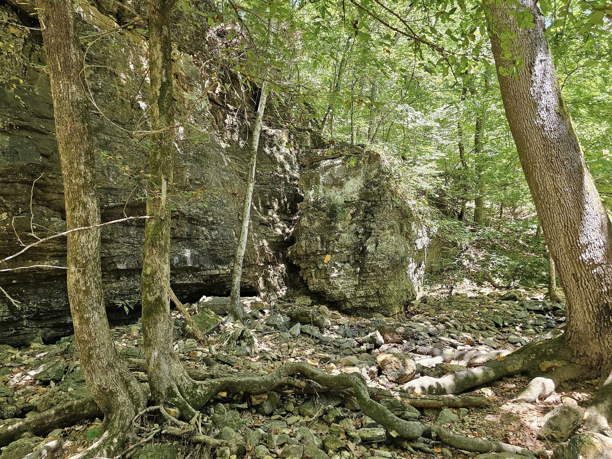
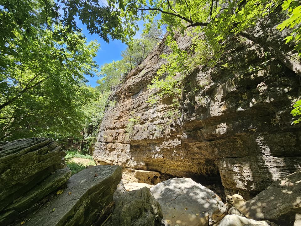
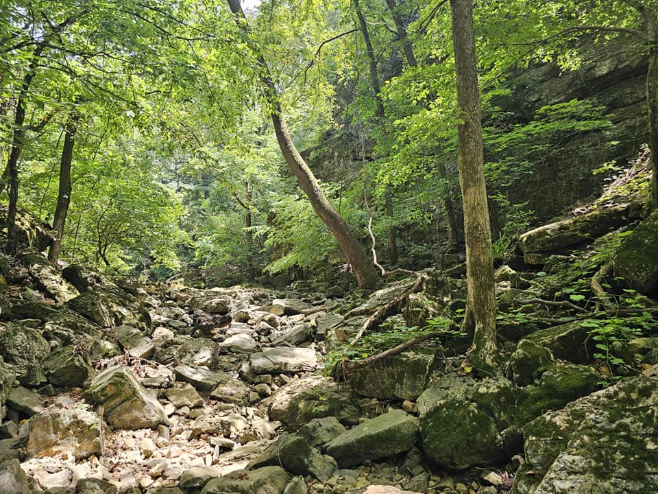
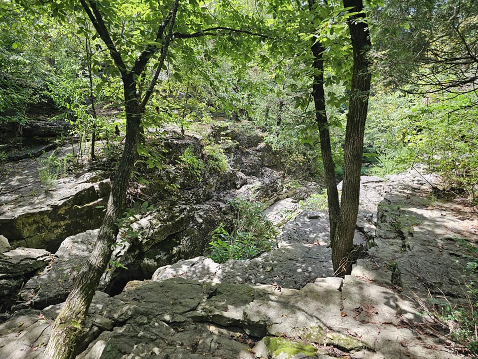
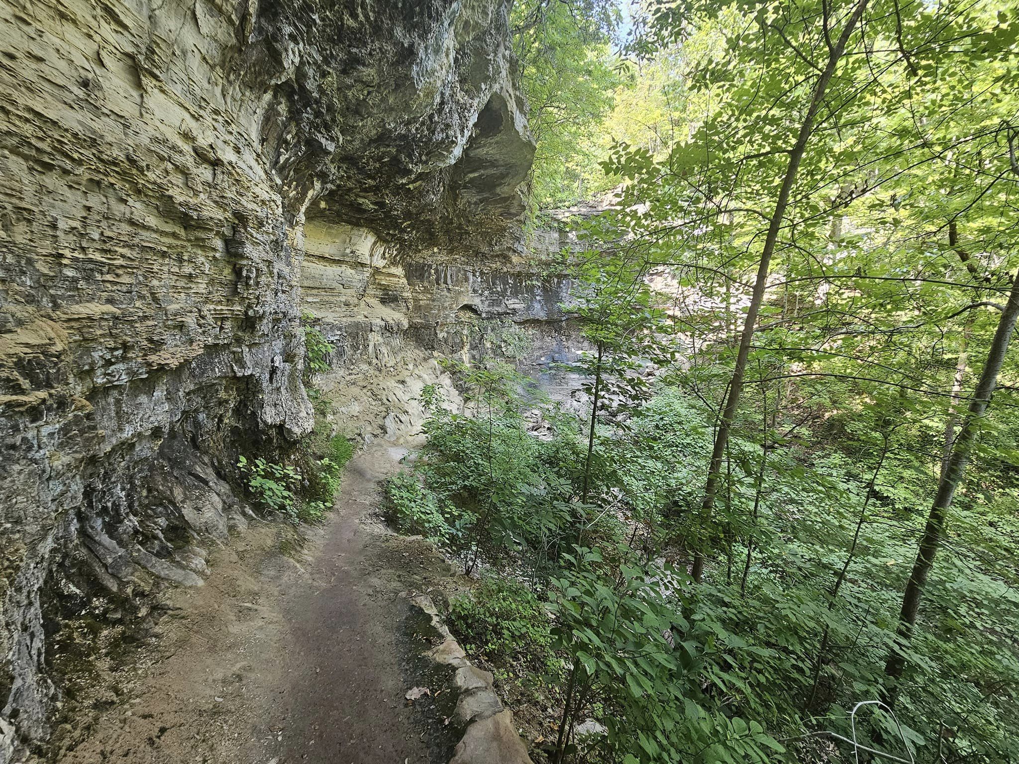
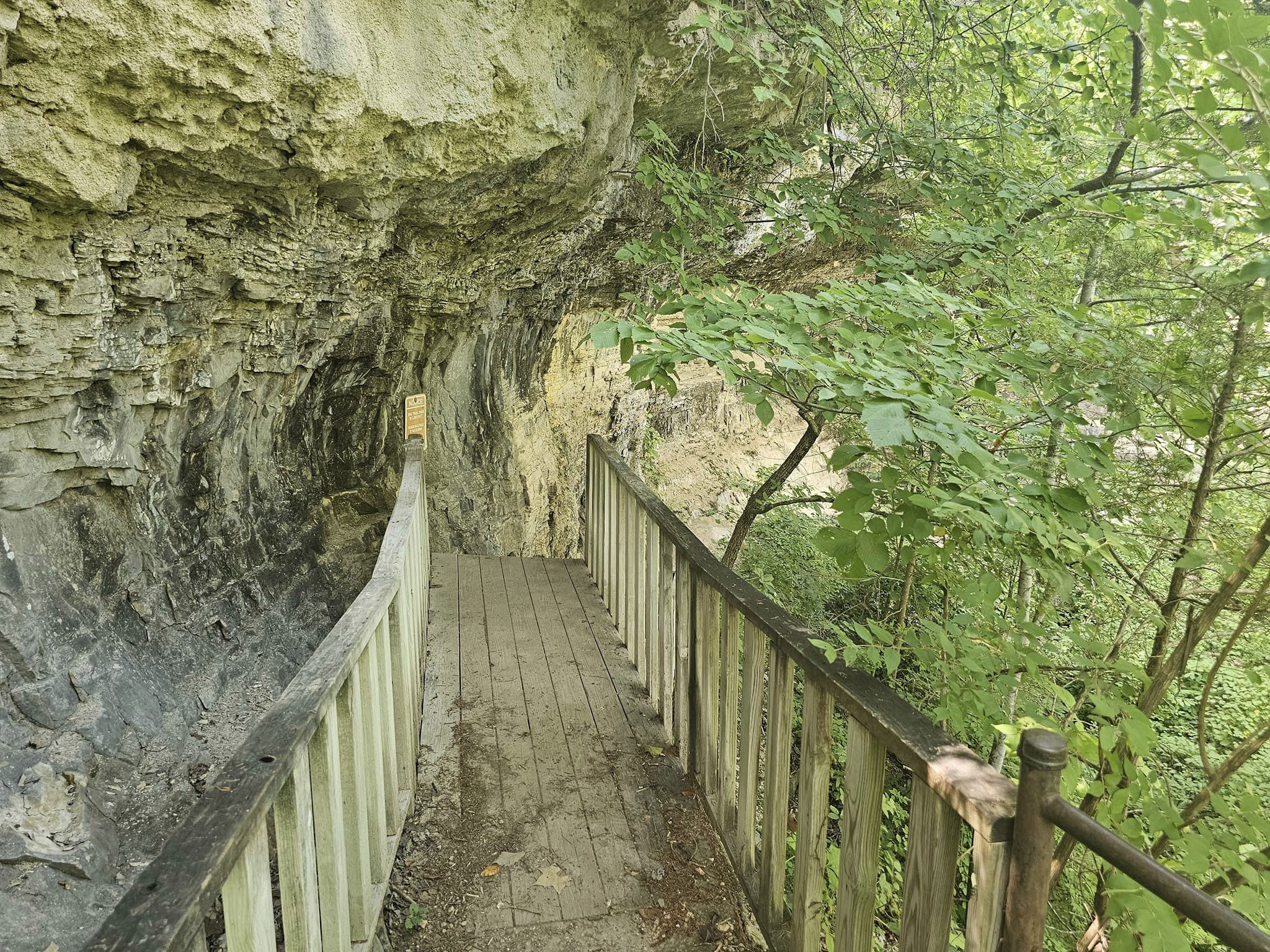
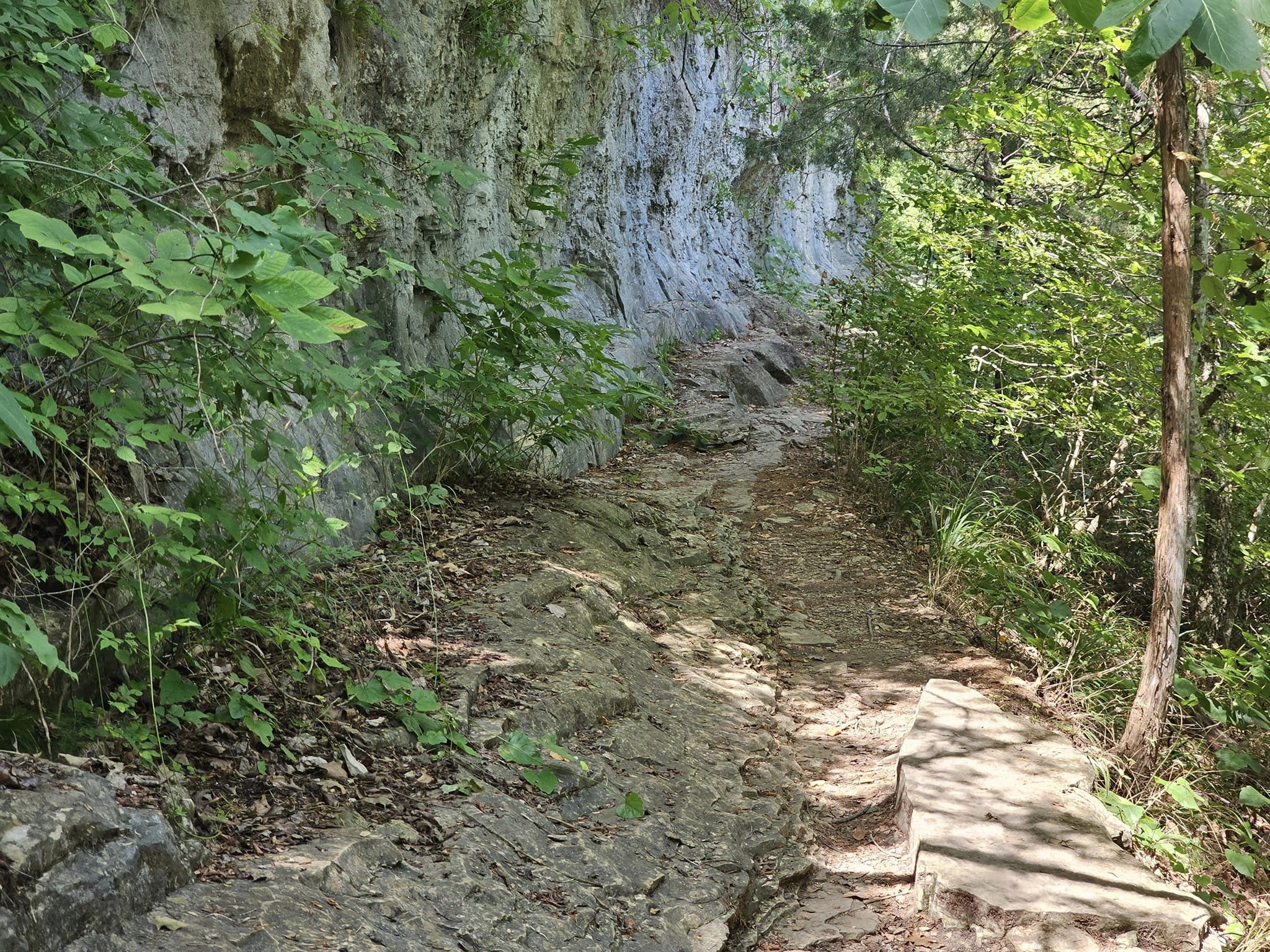
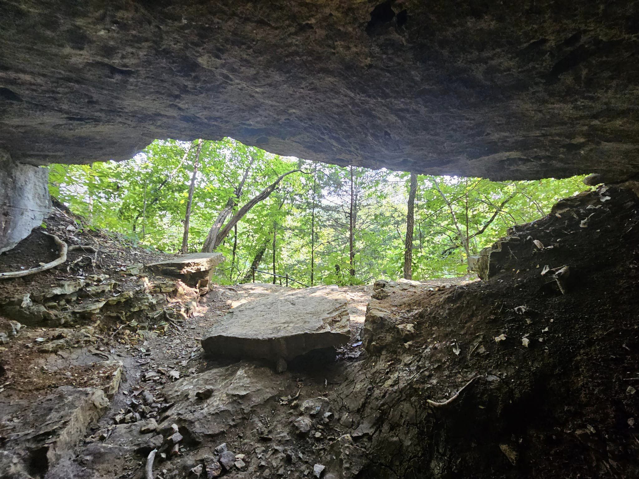
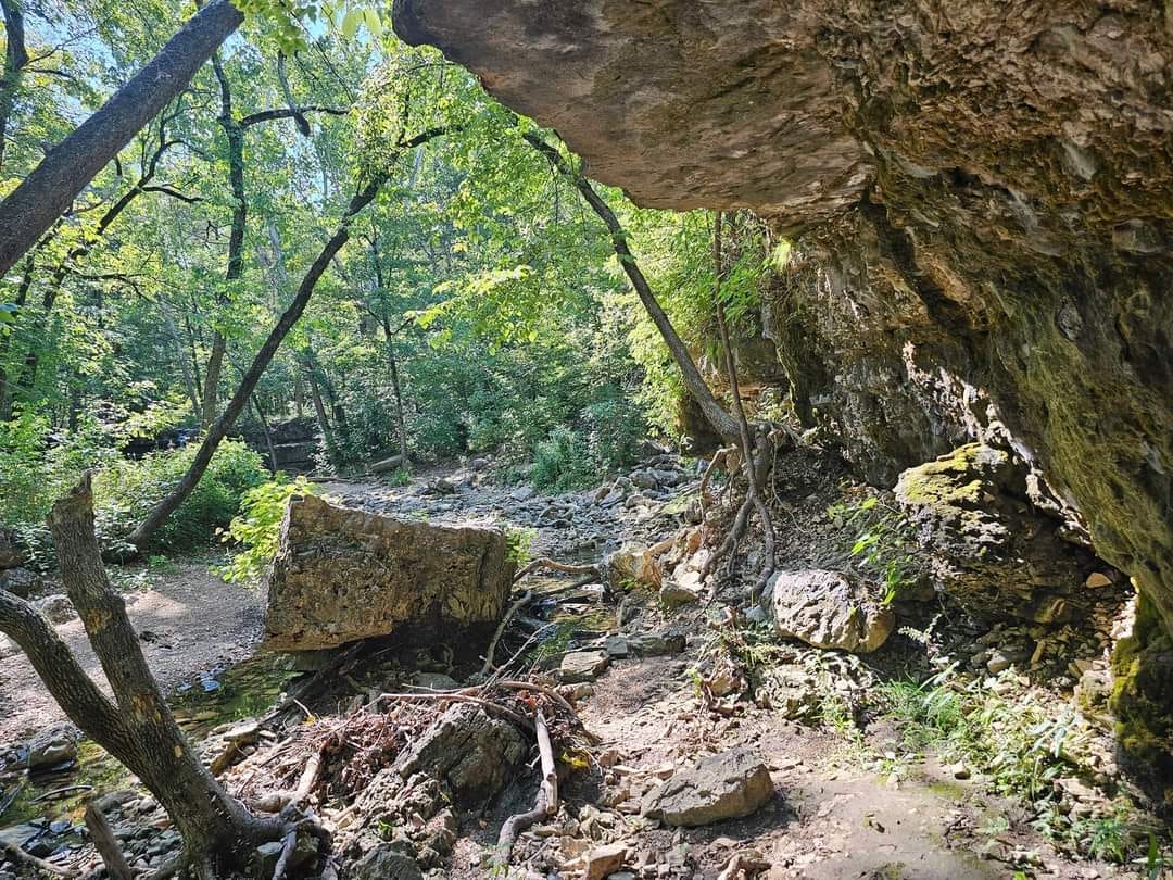
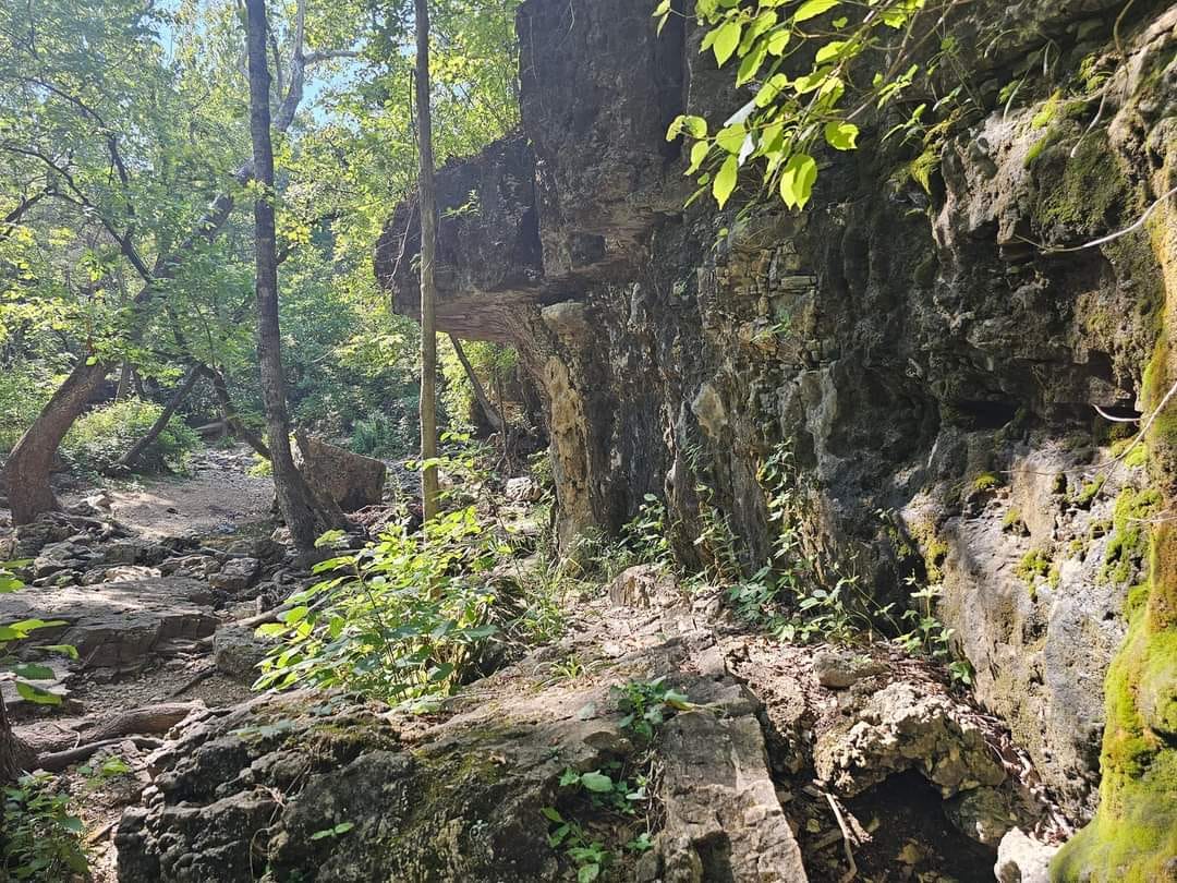
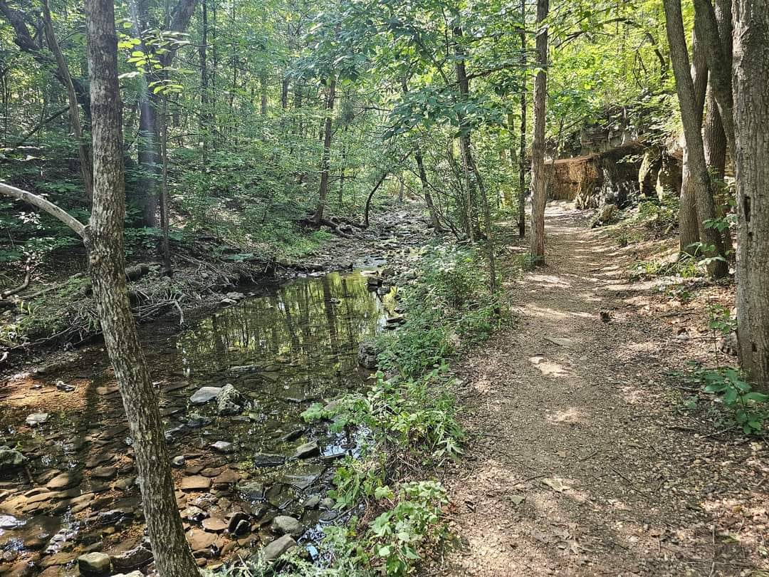
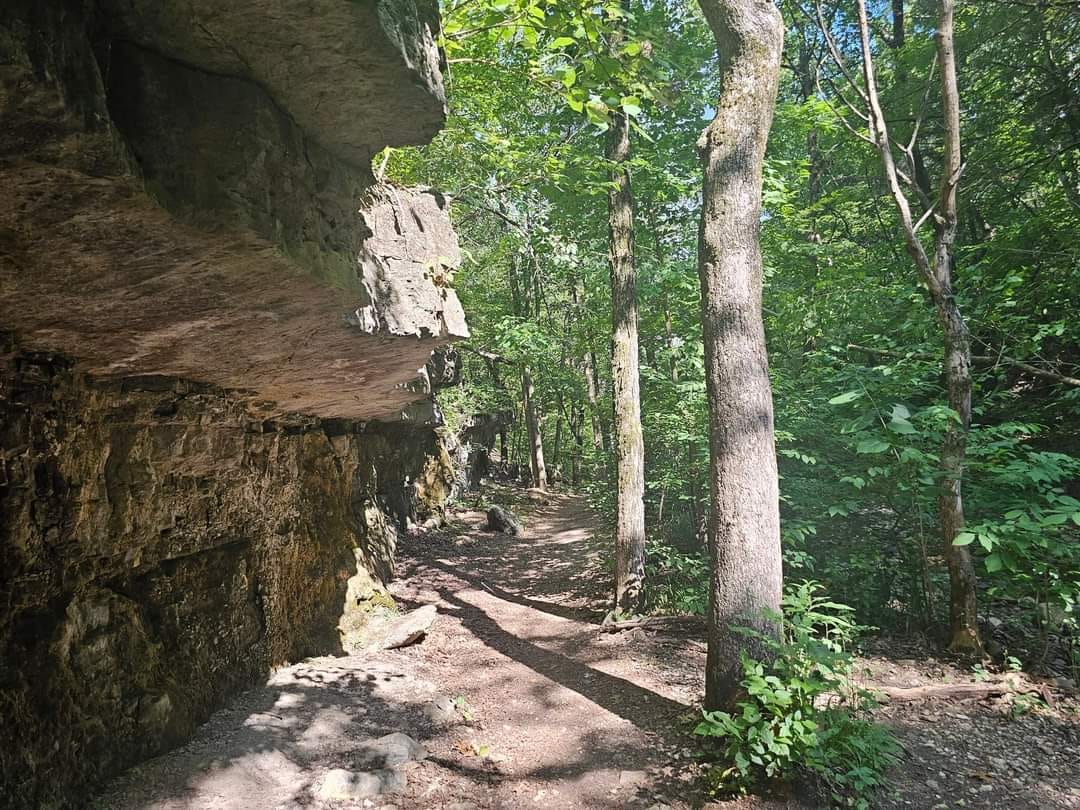
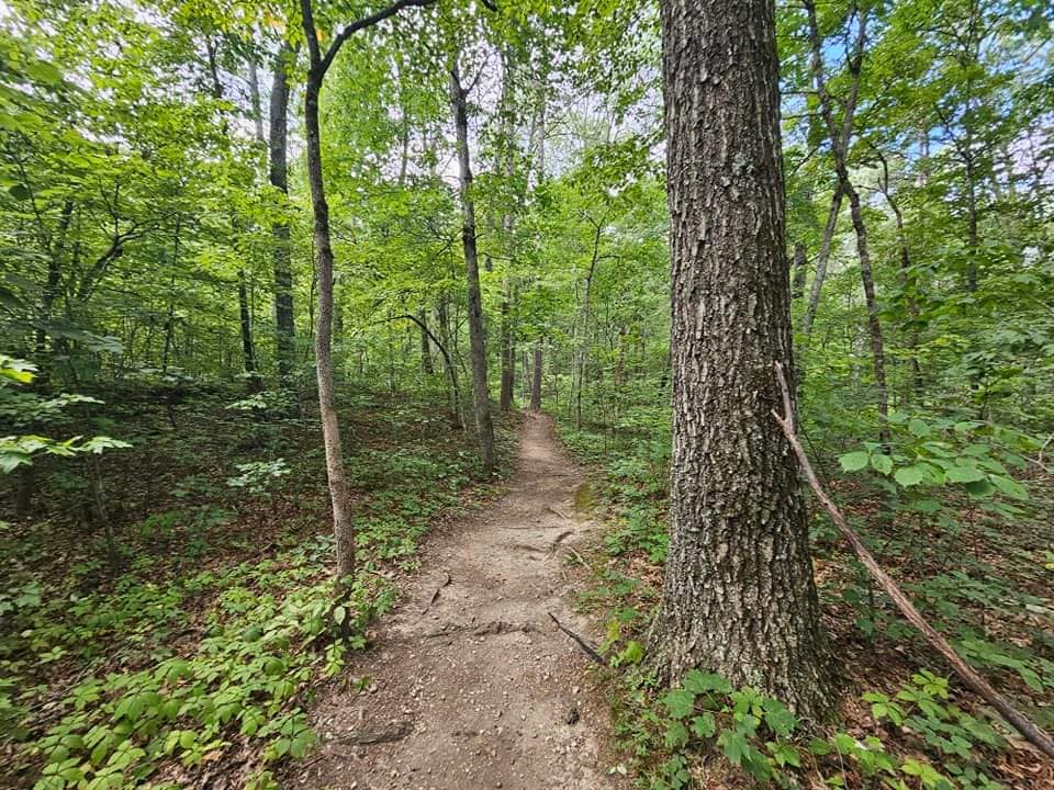
The United States National Forest Service maintains the trail to the spring. A parking area on the side of Highway 19 provides parking for the trail. Visitors to the spring are common despite a mile-long hike. The trail is well marked and easy to follow, there is an elevation change to reach the spring however the hike is fairly easy.

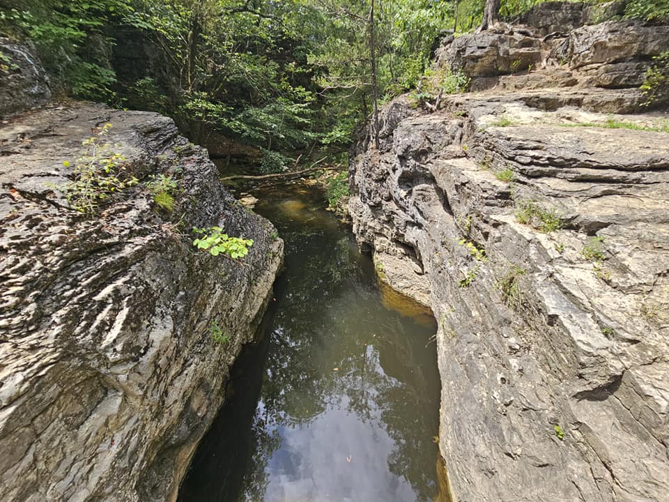
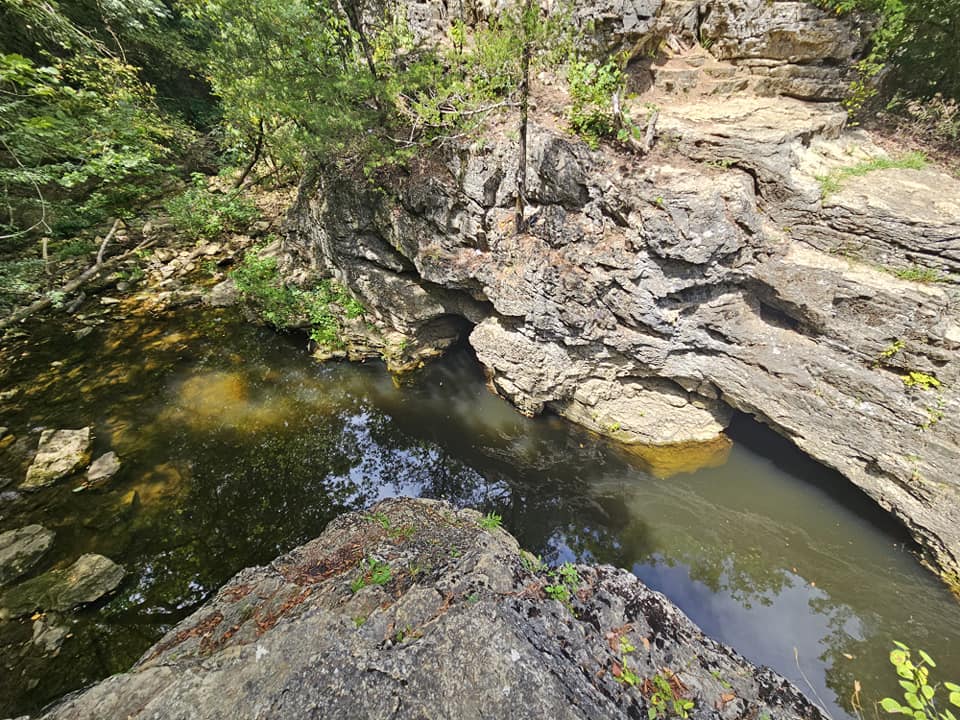
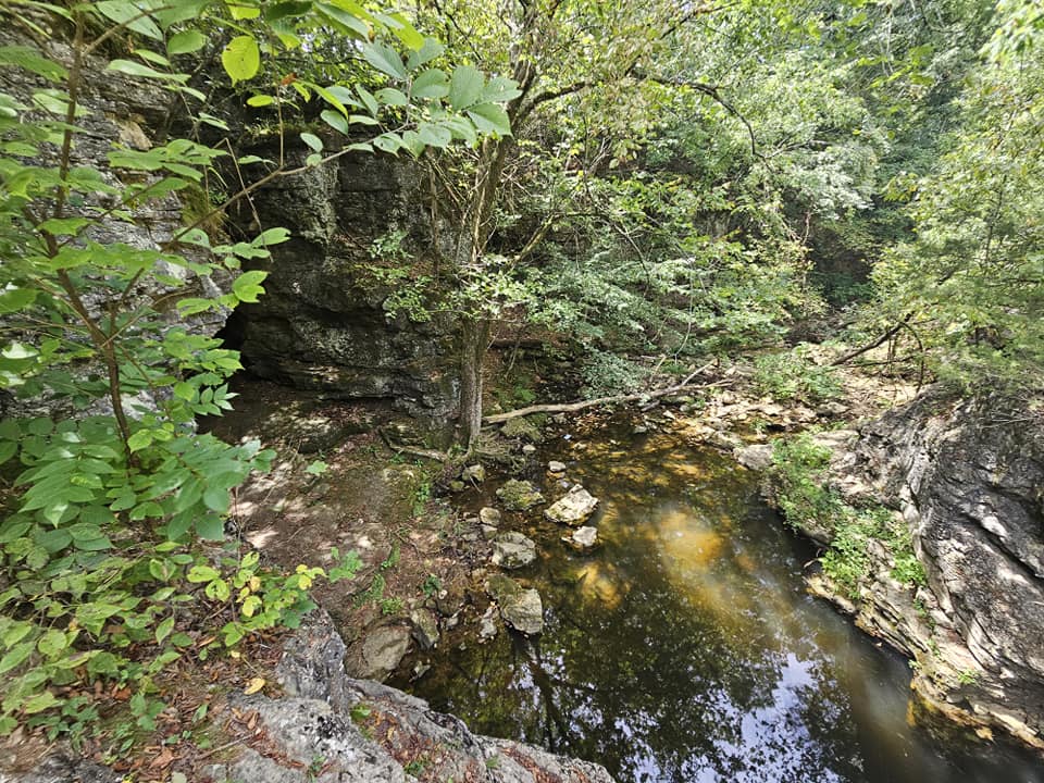
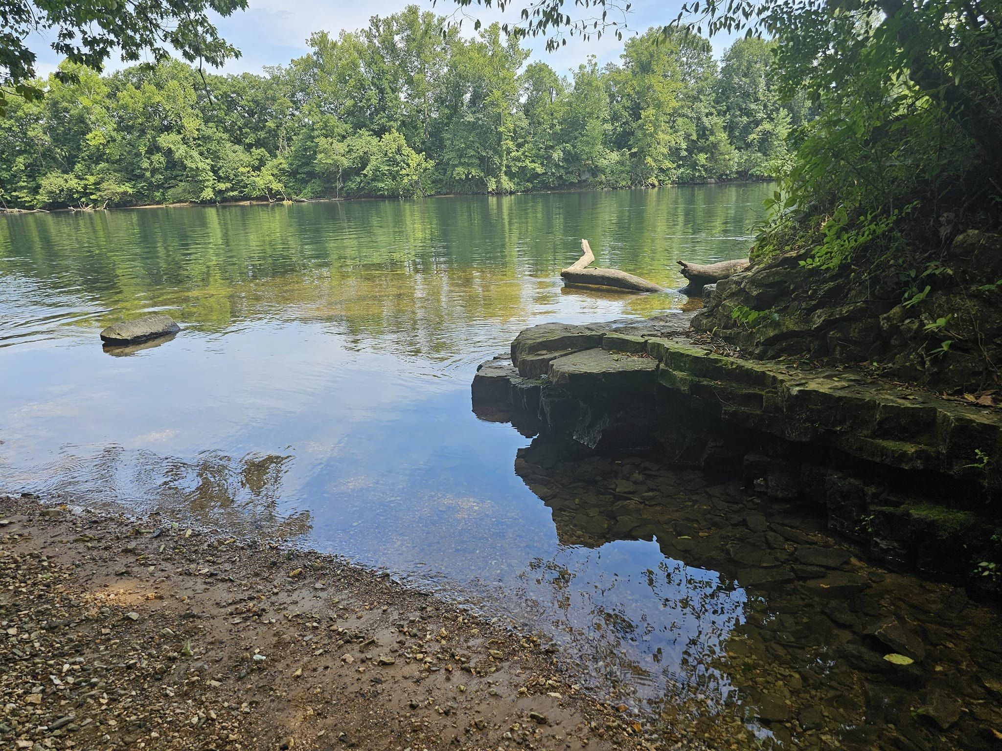
Greer Spring also has the longest spring branch of all the first magnitude springs in the state, flowing just over a mile before entering the Eleven Point River. This is a state and nationally significant geologic feature of a phreatic spring.

In addition to the geologic significance of Greer Spring, it is a significant aquatic natural community supporting a diverse assemblage of native fish species and aquatic invertebrates, including some species of conservation concern such as the cold-water crayfish.

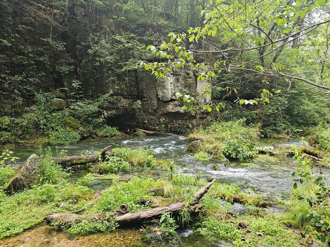
The flora of the spring branch and associated Ozark fens is diverse as well. Greer Spring is critically important to the hydrology of the Eleven Point River, a National Wild and Scenic River.

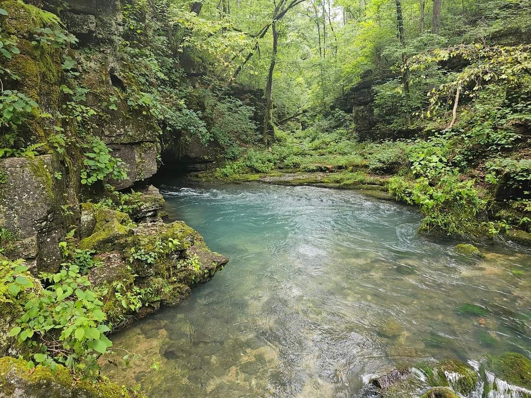
This is a fun hike and the trip down to the spring and back took just about 90 minutes. The trail is very well maintained and the spring and area surrounding it are gorgeous! Other nearby attractions include Big Springs and Grand Gulf State Park.

For more Amazing Locations in Missouri, click here. For the areas best lodging, click here. For the best family activities, you can click here.

There Is A Beautiful Canyon Hidden In The Ozarks That Very Few Know About

This incredible Natural Area is a hidden gem of the Ozark’s region, and a treasure trove of amazing curiosities! The Hall’s Creek Canyon Natural Area is literally packed with natural beauty, and is located in the town of Ravenden Springs, Arkansas!

From healing springs, a school cave, a bottomless swimming hole, and a rippling creek this natural area is just packed full of adventure. That doesn’t include the fossil laden creek bed or the towering bluffs that line the creek. This natural area truly is special.

Hall’s Creek Canyon Natural Area has 3 different healing springs located with-in its 33 acre boundaries! There are also numerous caves, I spotted at least four on my visit.

Ravenden Springs is one of the oldest settlements in Arkansas, and much of the town was formed as around the waters healing properties.

I have even read stories that the first school in Arkansas was located with-in a cave in Hall’s Creek Canyon. This school dates back all the way to the 1800’s.

Hiking thru the canyon is a thrilling experience, the trail is rugged in some spots but its worth struggle. Topography like this is extremely rare in this part of the Ozarks. This area is more known for its rolling hills. So to see towering bluffs, and caves, and all the unique rock formations is a real treat!

No trip to Hall’s Creek Canyon is complete without a visit to the spring fed pool just 100 feet from the parking lot. On hot summer days this is a perfect place to cool of in the chilling spring water. Stories in the area claim that the spring is bottomless and cliff divers have long attempted to reach the bottom with no luck.

After a long hike exploring the canyon, I decided to climb to the top of one of the cliffs near the spring and after working up some courage managed to jump into the cool water below. This was a thrilling experience, and there are even a couple small caves you can swim into. Remember always use extreme caution before jumping into unknown water and be sure to test the depth if you decide to jump.

For more amazing locations in Arkansas, click here. For nearby lodging options, click here. For a list of family activities in the area, click here.

This Missouri Park Has Fantastic Trails, Caves, and Stunning Views

Sodalis Nature Preserve is a 200-acre park property that was given to the city to preserve endangered bats. It is now Hannibal’s second-largest park. Sodalis Nature Preserve is located at 819 Ely St in Hannibal, Missouri. For more information, click here.

Access to the Nature Preserve is available off Ely Street, south of the Dempsey Dog Park and Bear Creek, 819 Ely St. A trailhead and parking lot are there, connecting it to the Bear Creek Trail ending at Ely Street.

Only non-motorized recreational activity is allowed, such as hiking, running and biking. The almost 2-mile loop trail is fully paved. See map below for the Pirate Ridge Trail that is unpaved. Other rustic trails will be developed over time.

The Conservation Fund, a non-profit group that protects properties for wildlife, recreation and/or historic significance, purchased the land through mitigation funds from the Canadian company Enbridge Inc.

More than 211,000 federally endangered Indiana bats hibernate in a former limestone mine that closed a half-century ago and in the cave network nearby.  The bats that hibernate in Hannibal make up about one-third of all known Indiana bats (their scientific name is Myotis sodalis, hence the preserve name.)

Specially-constructed gates have been built and set in place at each of the 33 mine entrances that allow the bats to come in and out of the mine, but keep people out.  The Fish and Wildlife Service will monitor and manage the bat population in the mine and on surrounding property.

According to Shauna Marquardt, Fish and Wildlife Biologist with the U.S. Fish and Wildlife Service, the highest concentration will be in October during the fall swarm, and is viewable from the amphitheater.  There is a nightly emergence each night during the spring and summer, starting roughly mid-April, ending in September, but the best time to view bats in the summer is probably June through mid-August.

For more Amazing Locations in Missouri, click here. For the areas best lodging, click here. For the best family activities, you can click here.

This Lakeside Hike In Missouri Provides Stunning Views And Amazing Sites

Sometimes while visiting Branson, its nice to get away from all the crowds.  Well The Lakeside Forest Wilderness Area is a perfect place to do just that. The Lakeside Forest Wilderness Area is located at 412 Owen Lane, in Branson, Missouri. For more information, click here. For directions to the park, click here.

Lakeside Forest Wilderness Area is located in the in the heart of Branson and offers a nature escape with 140 acres of wooded and rugged hill country and 5.3 miles of trails. Both visitors and locals can enjoy this unique park with its two woodland trails that wind through forest, along bluffs and across glades.

A set of 315 stone steps lead down toward Lake Taneycomo along a path that features a  stunning waterfall and cave. The property also features almost 2,000 feet of hand-built stone wells. The park is located off Fall Creek Road just south of Highway 76.

An entrance feature with a large wooden log archway over an ornamental iron gate with a decorative native stone veneer welcomes visitors to the park. Other recent improvements include a nature playground and pavilion near the entrance.

A covered porch swing that utilizes stone columns and rock from the original home site, established in 1911, can be found near a picnic area that provides beautiful views of Lake Taneycomo.

The  bluff trail (marked in blue) is my personal favorite, this trail takes you through a mature growth forest, and leads you to stunning views high above Lake Taneycomo. Follow the trail down to  the lake and you will find a couple caves, and an epic waterfall. The hike is not easy but its totally worthwhile. As an added bonus, there is a unique spot to hit the lake at the very end of this trail. Its a great little cove to cool off in before hiking back to your car!

For more Amazing Locations in Missouri, click here. For the areas best lodging, click here. For the best family activities, you can click here.

This Epic Waterfall Trail In Missouri Leads To A Hidden Swimming Hole

Branson Missouri is full of amazing places, from incredible shows to breathtaking sites there’s a reason it’s one of the top destinations in the Midwest. Sometimes thou Branson can get a little crowded. If you are in the area and feel the need to get away from everyone, just head on over to the Branson Waterfall Trail and enjoy a scenic hike and even take a dip in one of the pools of water you find along the way. For more information, click here. For directions to reach the waterfall trail, click here. Trust me, you will need these directions!

The Waterfall Trail runs along an un-named tributary of Roark Creek and includes some beautiful rock formations, a waterfall, and a dense tree canopy.

The 1.8 mile long trail is an unpaved footpath, rugged in some locations, and crosses a creek in two locations. Since the trail runs along a natural creek, it is subject to closure during and after heavy rainfall.

The trail is located about 300 feet north of the intersection of Roark Valley Road and Shepherd of the Hills Expressway. Limited parking is available near the trail head adjacent to the charcoal plant.

Finding the parking lot is easy, however from there is not will marked. You will have the urge to cross the railroad tracks and head towards the visible body of water. I mean it makes sense that a waterfall would need to be near water. However you actually need to turn around and hike towards the entrance of Westgate. Just past the gate you will find the trail head that leads you into the woods.

There are two waterfalls on this trail, the first is smaller in size but its a great place to get in and swim. The water forms a nice pool and has a depth of 5 feet so I don’t recommend jumping or diving into the water. However it is a great place to enjoy the cool water.

The second waterfall is another half mile or so down the trail and is the more scenic of the two. This waterfall stands about 8 feet or so and is 30 feet across. This is a fun place to take pictures and enjoy the solitude.

I was there on a Saturday, in 100 degree weather and had the place to myself. From the lack of trash, I have a feeling this is a bit of a hidden gem. Please help keep this area beautiful, carry out your trash. Thanks for reading and have fun!

For more Amazing Locations in Missouri, click here. For the areas best lodging, click here. For the best family activities, you can click here.

« Older posts Newer posts »